


Smyrna Voting District, Pope County, Arkansas
About
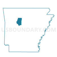
Outline

Summary
| Unique Area Identifier | 527749 |
| Name | Smyrna Voting District |
| County | Pope County |
| State | Arkansas |
| Area (square miles) | 70.72 |
| Land Area (square miles) | 70.71 |
| Water Area (square miles) | 0.01 |
| % of Land Area | 99.98 |
| % of Water Area | 0.02 |
| Latitude of the Internal Point | 35.66115550 |
| Longtitude of the Internal Point | -92.88970260 |
Maps


Graphs
Select a template below for downloading or customizing gragh for Smyrna Voting District, Pope County, Arkansas


Neighbors
Neighoring Voting District (by Name) Neighboring Voting District on the Map
- Freeman Voting District, Pope County, AR
- Jackson Voting District, Pope County, AR
- Mt. Pleasant Voting District, Searcy County, AR
- Richland Voting District, Newton County, AR
- Washington Voting District, Van Buren County, AR
- Wheeler Voting District, Van Buren County, AR
Top 10 Neighboring County Subdivision (by Population) Neighboring County Subdivision on the Map
- Jackson township, Pope County, AR (1,110)
- Mount Pleasant township, Searcy County, AR (465)
- Wheeler township, Van Buren County, AR (336)
- Smyrna township, Pope County, AR (187)
- Archey Valley township, Van Buren County, AR (144)
- Freeman township, Pope County, AR (102)
- Jones township, Newton County, AR (29)
Top 10 Neighboring Unified School District (by Population) Neighboring Unified School District on the Map
- Clinton School District, AR (9,129)
- Searcy County School District, AR (6,747)
- Hector School District, AR (3,627)
- Deer/Mount Judea School District, AR (2,393)
Top 10 Neighboring State Legislative District Lower Chamber (by Population) Neighboring State Legislative District Lower Chamber on the Map
- State House District 69, AR (31,441)
- State House District 70, AR (29,754)
- State House District 90, AR (29,000)
Top 10 Neighboring State Legislative District Upper Chamber (by Population) Neighboring State Legislative District Upper Chamber on the Map
Top 10 Neighboring 111th Congressional District (by Population) Neighboring 111th Congressional District on the Map
- Congressional District 3, AR (822,564)
- Congressional District 2, AR (751,377)
- Congressional District 1, AR (687,694)
Top 10 Neighboring Census Tract (by Population) Neighboring Census Tract on the Map
- Census Tract 1802, Newton County, AR (4,253)
- Census Tract 4602, Van Buren County, AR (3,876)
- Census Tract 9507, Pope County, AR (3,871)
- Census Tract 4601, Van Buren County, AR (3,552)
- Census Tract 9701, Searcy County, AR (2,329)